

Dartmoor Mobile Signal & Safety Guide for Landscape Photographers

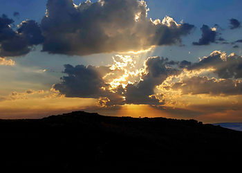
There is nothing quite like standing on a remote Dartmoor tor at 4:30 AM, watching the morning mist weave through the valleys while the rising sun paints the granite in deep gold. It’s a landscape photographer’s paradise.
But Dartmoor is as unforgiving as it is beautiful.
Within thirty minutes, a clear golden hour can devolve into a blinding, zero-visibility mist. The ground can shift from solid turf to a treacherous peat bog. And when you look down at your phone to check your radar or maps, you’ll likely see the dreaded words: No Service.
Because Dartmoor sits on a massive granite batholith riddled with deep, steep valleys, mobile signals are incredibly unpredictable. Here is a definitive guide to managing your mobile coverage, navigating safely, and protecting your gear when chasing the light on the moors.
1. The Mobile Signal Reality Check: What to Expect

Don’t trust the standard, glossy coverage maps provided by major network providers. While service is slowly improving in the main villages, the open moorland tells a completely different story.
The Valley Blackspots: The moment you descend into deep river valleys or wooded cleaves (like Lydford Gorge, Wistman’s Wood, or sections of the River Dart), your signal will vanish. The steep topography completely blocks line-of-sight to distant masts.
The High Tor Advantage: Generally, you will find a baseline signal (often 4G, or even patchy 5G) once you summit prominent, elevated tors like Haytor, Great Staple Tor, or Hound Tor. However, wind and weather conditions can cause this signal to fluctuate wildly.
The Network Divide: EE traditionally holds the strongest, most stable reputation for coverage across rural Devon and the fringes of Dartmoor. Vodafone is improving, notably adding a micro-4G cell at the Postbridge Visitor Centre, but O2 and Three remain highly spotty once you get deep onto the open moors.
2. Essential Offline Navigation Tools
Because you cannot rely on a live data connection to stream Google Maps or Apple Maps, you must prepare your digital toolkit before leaving your house.
The Ordnance Survey (OS) Maps App

Do not venture onto Dartmoor without downloading the OS Explorer OL28 (Dartmoor) map for offline use (or the physical Double-Sided Laminated version if you prefer).
The Tip: A premium subscription allows you to download entire sections of the high-detail 1:25,000 mapping directly to your phone storage. This uses your phone's internal GPS (which works even without a cellular network or SIM card) to pinpoint your exact location on a topographical map.
What3Words

Emergency services across Devon and Cornwall rely heavily on What3Words.
The Tip: Download the app and ensure you open it while you still have data so its global grid database is cached. If you twist an ankle on a granite boulder or get lost in a sudden whiteout, you can read the three-word address to emergency services via a standard 999 voice call (which will automatically jump onto any available network network, even if your provider shows "No Service").
3. The 3 Biggest Safety Hazards for Photographers
Landscape photographers face unique risks because we actively seek out extreme weather, low light, and remote positions. On Dartmoor, watch out for these three specific hazards:
1. The Military Firing Ranges (The Northern Moor)

Large sections of the northern moor (around Okehampton, Merrivale, and Willsworthy) are active military training zones. When live firing is happening, red flags are raised by day and red lamps are lit by night.
The Safety Step: Never assume a range is clear because it "looks quiet." Before planning a sunset or sunrise shoot near Yes Tor, High Willhays, or Great Mis Tor, check the official Dartmoor Firing Programme online.
2. Dartmoor "Mires" (Peat Bogs)

Some parts of the high moor hold water like a sponge. Areas like Aven Head Mire or Fox Tor Mires look like flat, innocent green lawns but can swallow a walking boot (and a tripod) instantly.
The Safety Step: Avoid bright, fluorescent green mosses, this usually indicates deep, unstable standing water. Stick to established tracks when navigating in the dark, and use a head-torch with a strong "flood" beam to read the texture of the ground ahead of you.
3. Sudden Microclimates & Mist

Dartmoor generates its own weather. You can start a hike under clear skies and be completely enveloped by a dense "Dartmoor blanket" (thick fog) within 15 minutes, completely erasing the horizon and your landmarks.
The Safety Step: Always carry a traditional magnetic compass and a physical, waterproof OS map as a backup to your phone. If the mist rolls in and your phone battery dies from the cold, a compass is your only way off the moor.
4. Photographer’s Checklist: Before You Head Out

Before you pack your camera bag and head out into the Devon wilderness, tick off these essential safety protocols:
[ ] Leave a Route Plan: Tell a partner, family member, or friend exactly which tor you are parking at, which direction you intend to walk, and your estimated time of return.
[ ] Pack a Power Bank: Cold moorland winds drain lithium-ion phone and camera batteries at twice the normal speed. Keep your phone in an inside pocket close to your body heat.
[ ] Check the Dartmoor Firing Times: Confirm the ranges are open to the public if you are shooting the northern moor.
[ ] Dress for the Moor, Not the Forecast: It is routinely 3C to 5C colder on the high tors than it is in nearby coastal towns like Plymouth or Exeter, with savage wind chills. Bring layers, waterproofs, and sturdy footwear with good ankle support for scrambling over granite clitter.
[ ] Store Emergency Numbers: If you get in trouble on Dartmoor, call 999 with as much information to your location as possible.
Report uncontrolled dogs or sheep attacks directly to the police on 101 or the Livestock Protection officer.
All livestock including ponies are owned by local farmers and commoners. If you come across injured livestock please phone the Livestock protection officer directly with as much information as possible. Livestock Protection officer: 07873 587561
Explore Dartmoor Confidently with an Expert

If you want to capture the rugged beauty of Dartmoor’s wild tors, prehistoric stone circles, and dramatic rivers without the stress of navigating the terrain alone, let’s head out together.
Our 1-on-1 Outdoor Photography Workshops are completely tailored to your fitness level, experience, and creative goals. We handle the scouting, the safety, and the logistics, allowing you to focus entirely on mastering your camera settings and capturing incredible images.


Comments